UST21 – Connect the Present of the Ocean and the Future of the World Together
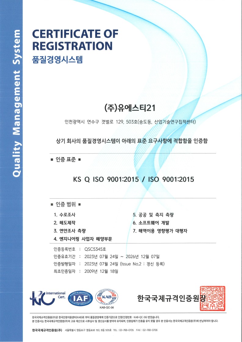
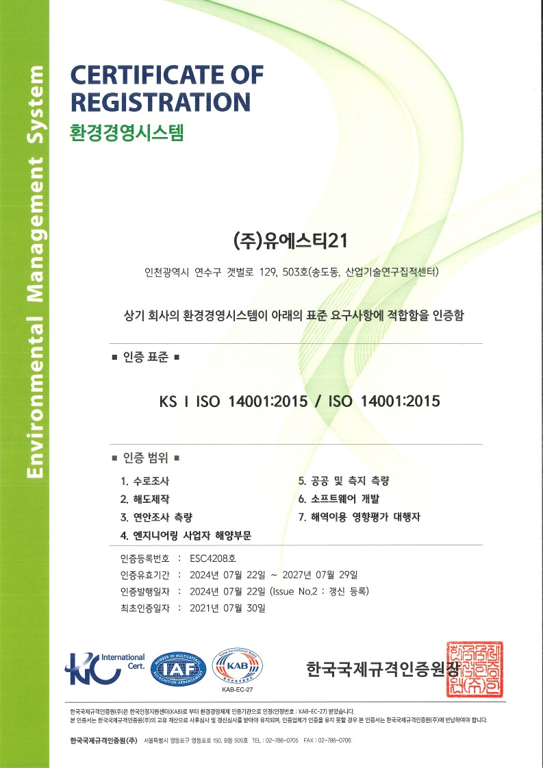
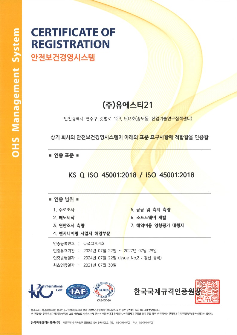
UST21 forges, processes, analyzes, and predict maritime data with high quality continuously and ceaselessly pursuant to the international quality standards.
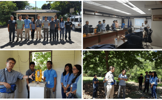
It produces constant achievements with forging, processing, and analyzing 3D data obtained from the international QHSE system, high-end equipment, etc. and provides potential insight with numerical modelling and AI.
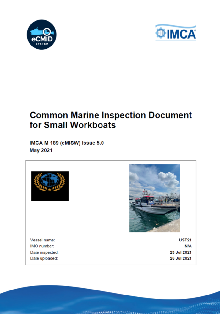
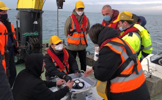
Vessel ‘UST21’: certificated on Common Marine Inspection Document for Small Workboats by the International Marine Contractors Association (IMCA)
Providing comprehensive maritime information solutions on ocean survey and observation, numerical model, remote sensing, digitalized data, etc. by maritime professionals
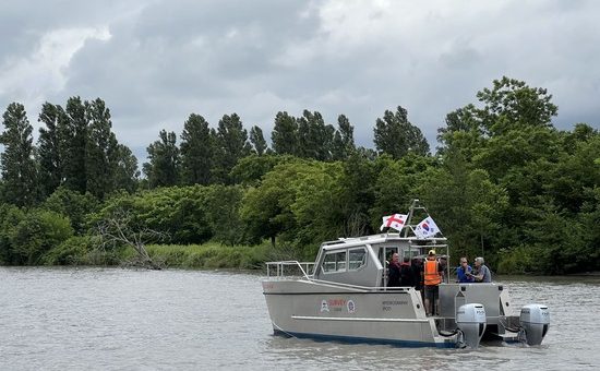
Maritime professionals are co-working at various fields such as ocean survey and observation, numerical model, remote sensing, ENC (Electronical Navigational Chart), Data Base& GIS, etc. and providing comprehensive maritime information solutions that their customers want.
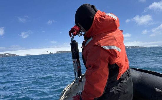
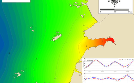
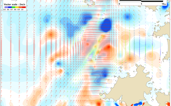
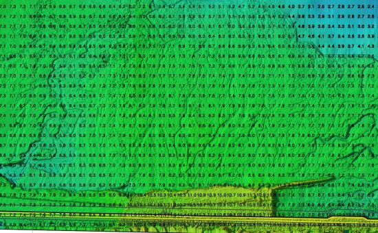
Observe and analyze Tides, ocean physics and properties such as tidal currents, water temperature, salinity, etc.
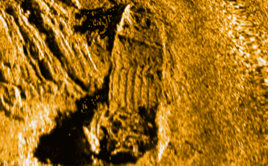
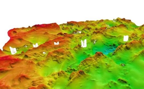
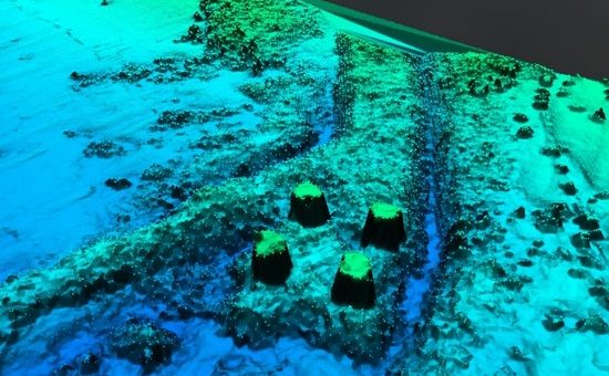
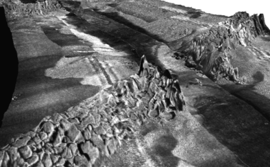
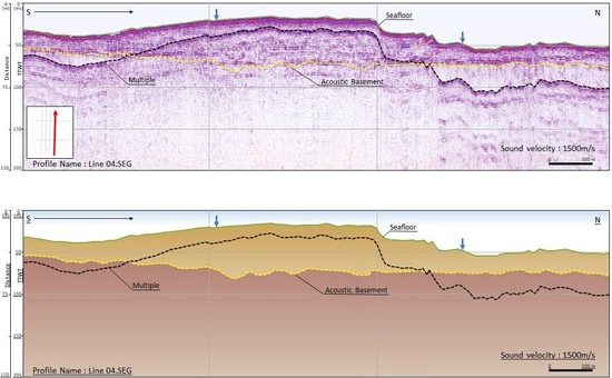
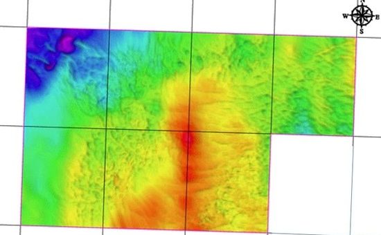
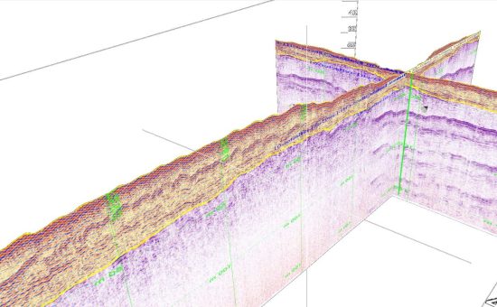
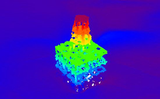
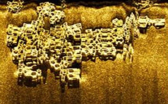
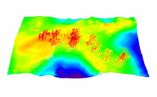
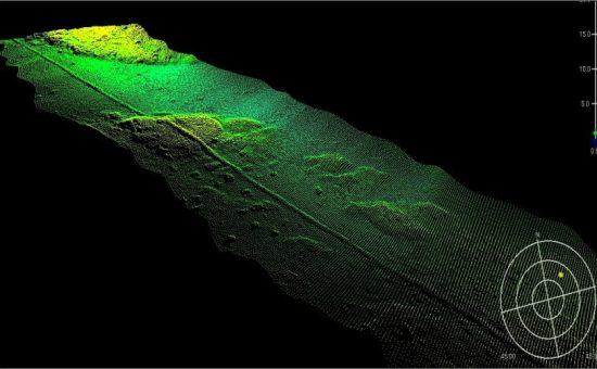
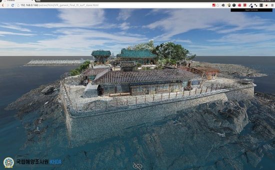
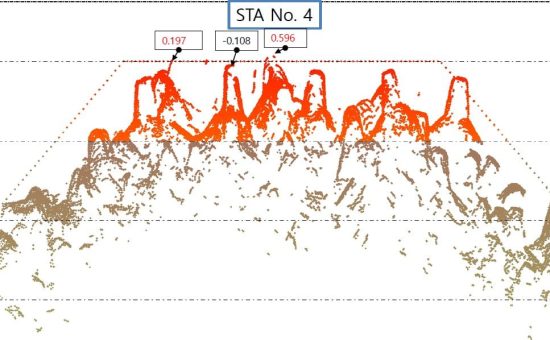
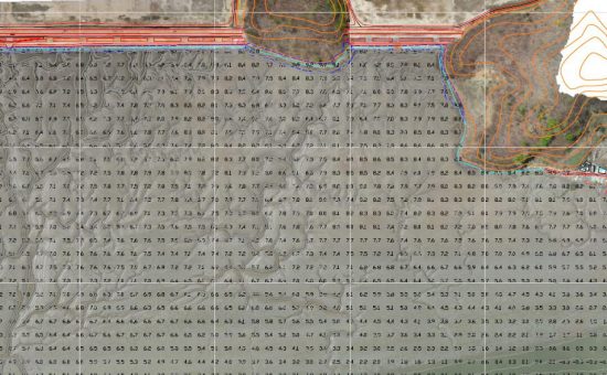
Survey 3-D submarine topography
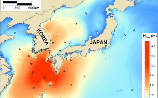
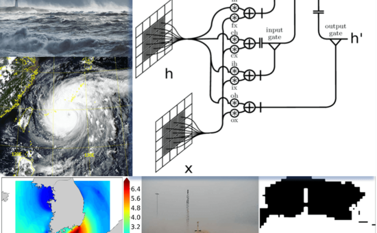
Observe and predict marine weather environment and support to take actions against marine disasters
Support maritime engineering businesses customized and solid for sustainable ocean development and reservation pursuant to international standards
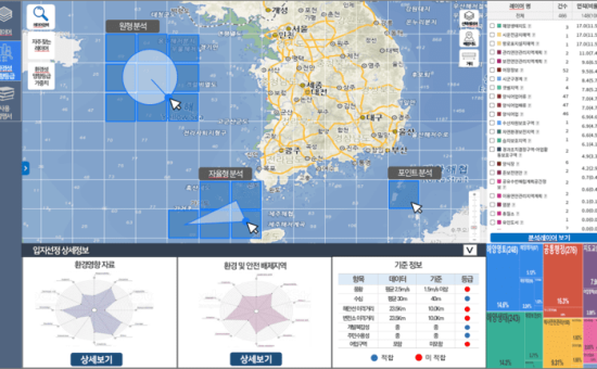
Provide specific and efficient solution including surveying proper site for ocean development & reservation such as ocean renewable energy, ocean ecosystem and submarine infrastructures, ocean survey, ocean observation, numerical model, licensing, outcomes of international standards
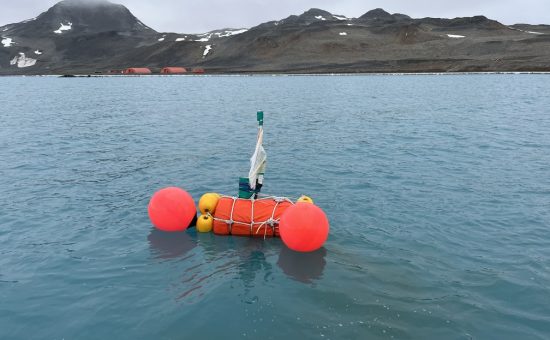
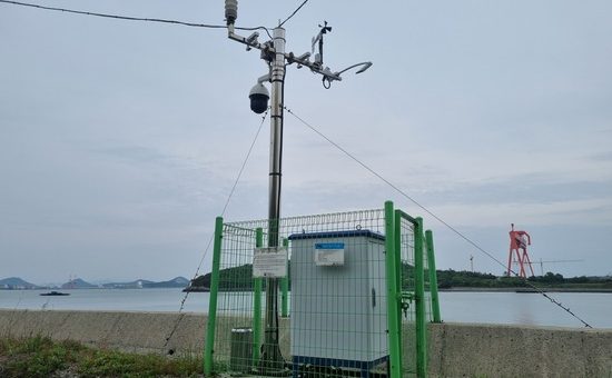
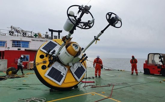
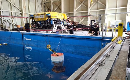
Produce and manage floating ocean observation facilities
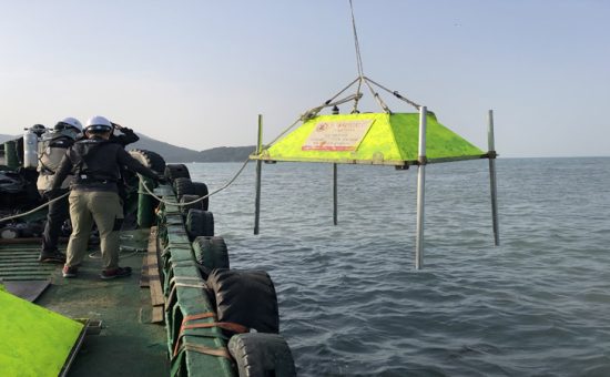
Design, install, manage survey structures and facilities
Survey aggregate fields and deposits
Monitor the condition of artificial reef installation and select proper sites of the reefs
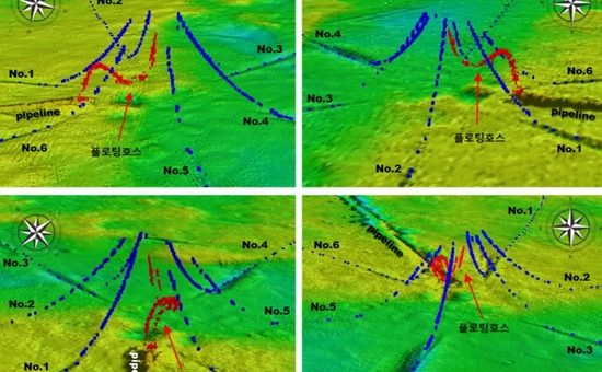
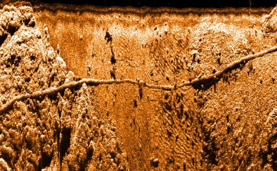
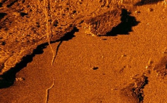
Survey paths of sea-bottom pipeline.
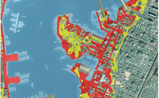
Carry out environmental evaluations on marine industry developments
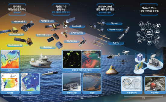
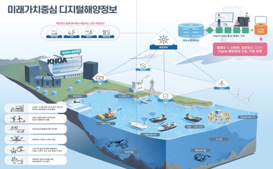
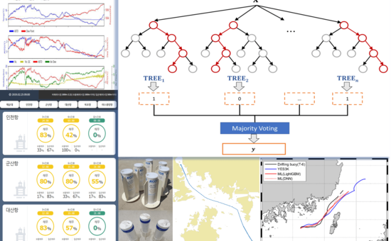
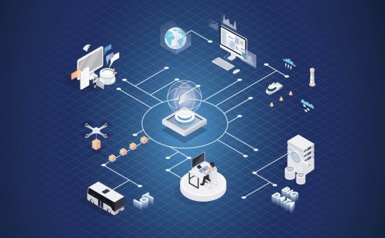
Based on Big Data & AI, refine, process, manage, analyze, predict and visualize
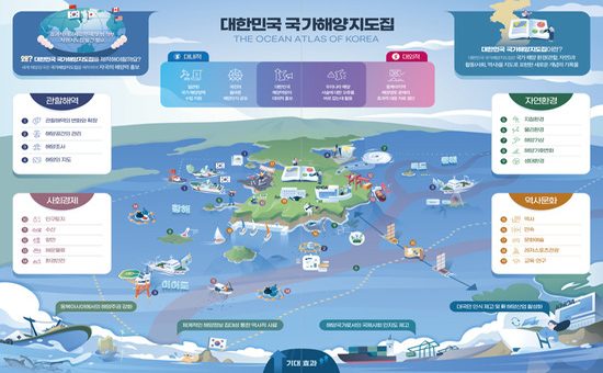
Provide the customized data refined, processed, managed, analyzed, predicted, and visualized, based on submarine topography, ocean environment, satellite images, etc. by utilizing Big Data and AI technology, pursuant to the international standards
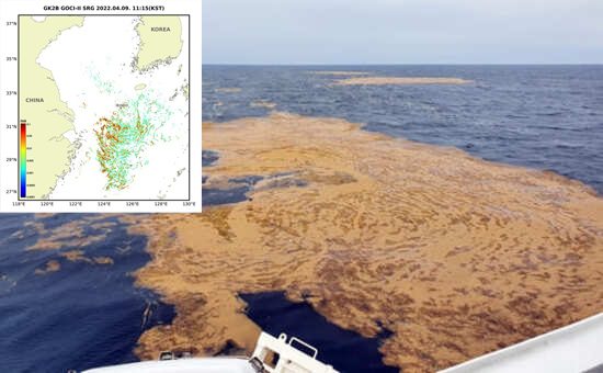
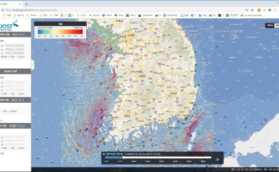
Analyze the data from the marine observation satellites
Provide the data predicted by numerical models
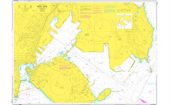
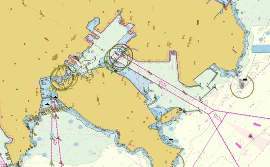
Produce paper & electronic navigational charts and nautical publications
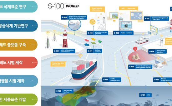
Research and produce oceanographic information of S-100 standards
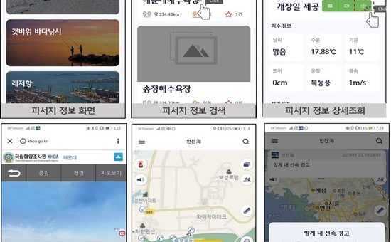
Develop the systems to visualize marine information
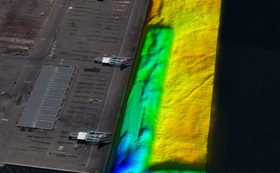
Explore the shorefaces and soil structures
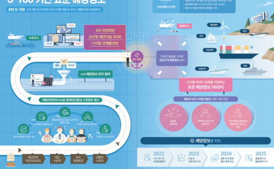
Design, research and development of next-generation ocean survey, observation, prediction, digitalization to lead the global maritime technology
Research core technology (software, hardware, etc.) related with next-generation ocean survey, observation, prediction, digitalization to lead the global ocean technology such as S-100 of IHO, MASS (Maritime Autonomous Surface Ship), smart port, MSDI (Marine Spatial Data Infrastructure), Unmanned Maritime Survey System, etc
Develop software & hardware for survey
Develop the systems to visualize marine information / Visualize marine information and Monitor based on IOT in real time
Cooperate with the global countries through ODA (Official Development Assistance)