UST21 – Connect the Present of the Ocean and the Future of the World Together
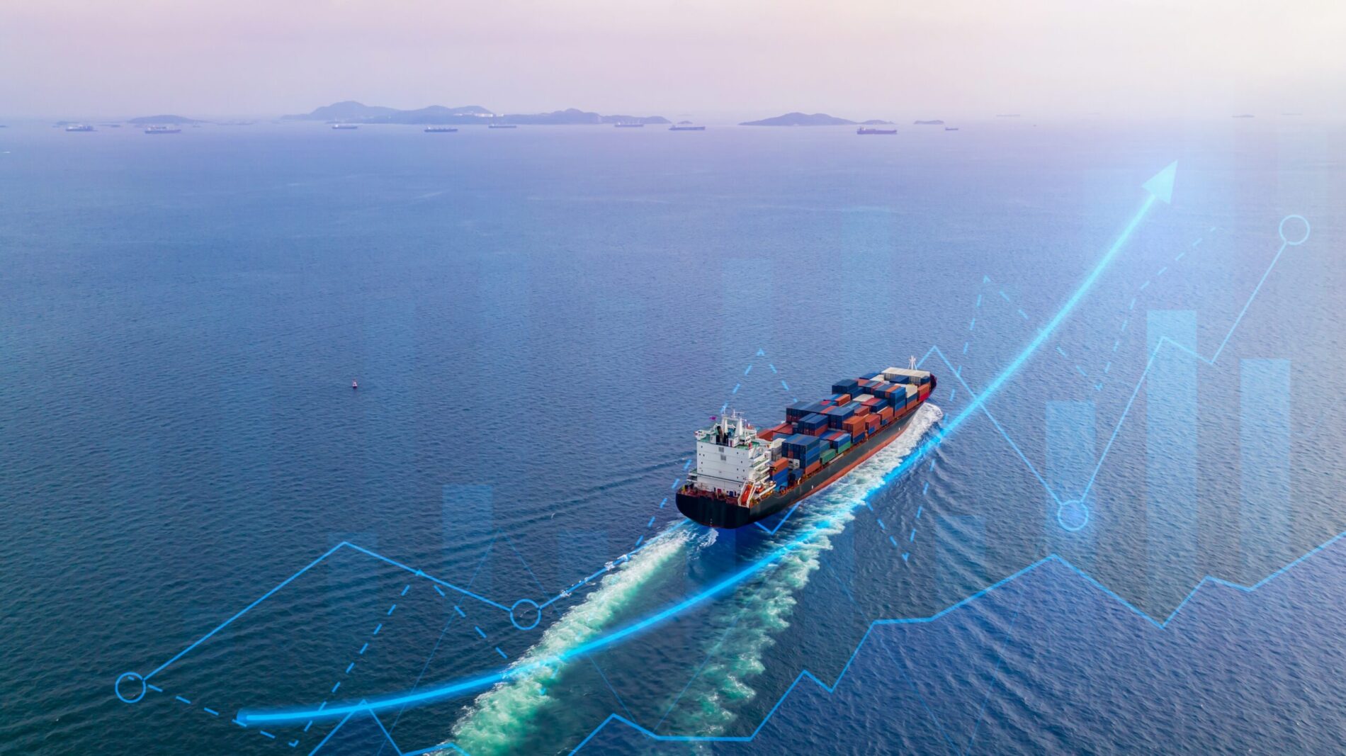
High-end technology can make safe ways on unpredictable ocean open, accurately figure out topography and geology, which human-being can’t enter, predict that ocean development industries will influence on marine ecosystems, and verify the complicated correlation between maritime climates and environment of the earth.
The oceans must be surveyed from the universe, seen through with geophysical technologies. By doing so, we must forge and analyze various, dynamic and enormous data, reveal mutual relationships and predict the changes from them.
UST21 has been investing time and money in developing technologies and advanced equipment, raising professional personnel to survey the ocean and analyze the data precisely and carry out the various surveys and development projects which conduct in the sea. Now, it has already held the global technology capability as high as to adopt as the international standards.
Technical Professionals
The number of Engineers
0
persons
The number of Specialists
0
persons
The number of Doctor’s Degree
0
persons
The number of Master’s Degree
0
persons
Affiliated Institute
It consists of professionals in the fields of software & hardware and has been researching new technologies regarding oceans and developing new products from various angles.
It concentrates on developing technologies of software & hardware concerning a variety of fields including big data analysis system through management of large-scale submarine topography and machine learning, visualizing maritime contents through virtual reality and augmented reality, unmanned observation system, maritime IoT, etc.
Maritime Survey
Maritime Observation
Spatial Information
Oceanographic forecast
Responsibility: Blue Headquarters.
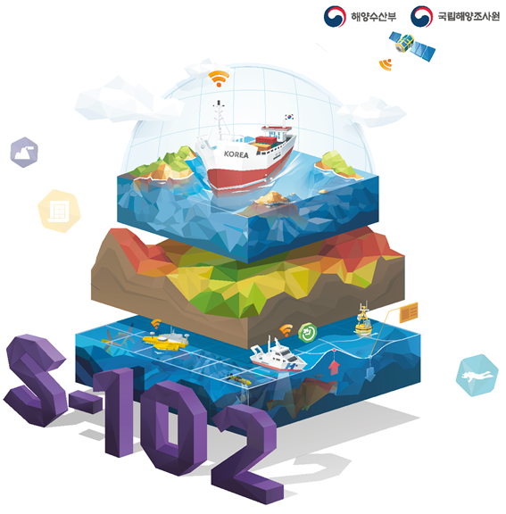
S-102
Research bathymetric surface with grid system applying uncertainty
Provide standards for TPU reporting suitable for domestic states
Analyze uncertainty for producing bathymetric surface
Provide procedures to produce bathymetric surface and methods to apply SEP model
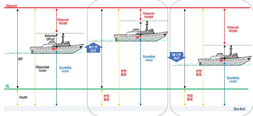
HAE (Hight Above Ellipsoid)
Analyze uncertainty for HAE(Hight Above Ellipsoid) survey methods & obtained data
Forge coherent geoid data with HAE(Hight Above Ellipsoid) survey
Compare uncertainty between HAE(Hight Above Ellipsoid) survey and sounding based on DL
Compare data between from 2-frequency GNSS equipment and POS/MV
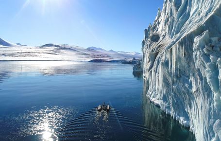
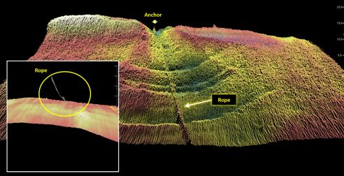
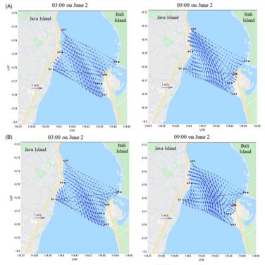
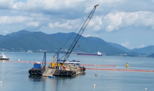
Unmanned Survey (The Polar Regions)
Reducing working risk by using unmanned survey equipment, survey the areas around the Jangbogo Antarctic Research Station and the King Sejong Station, and produce nautical charts
Offshore Wind Power
Basic research for constructing offshore wind power
Registration as eCMID(vessel safety management system of international standards for overseas companies and business)
Responsibility: Blue Headquarters
Tide/Tidal current Observation
Produce the vertical reference data for the ocean and land areas, sea water circulation per layer and the characteristics data of wind waves by connecting short-and long-term tidal observation, leveling and GNSS observation suitable for the characteristics of the waters
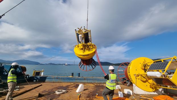
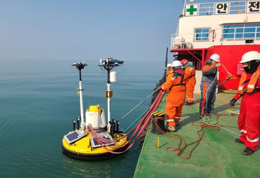
LiDAR Buoy
Produce and manage floating type maritime observation systems for forging ocean physical properties and weather information
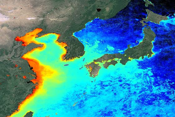
Satellite
Develop the technique of image processing obtained from remote sensing
Operate a calibration laboratory for satellite images
Multisensory image analysis algorithm
Big data high-speed computation & management
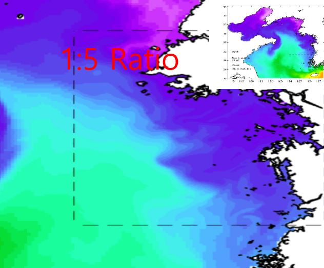
Tomography
Research the methods to observe the maritime physical characteristics by utilizing the signal processing results of sounding collected at the different stations
Responsibility: Data Headquarters.
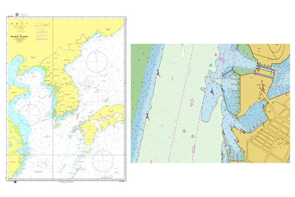
Produce Nautical Charts
Since beginning the service of producing nautical charts with high quality in 2010, it has been conducting businesses concerning producing digital marine topographic charts of new/revised version, electronic navigational charts.
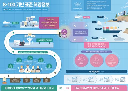
Research related with S-100 Standards
Research the international standards related with Trend analysis of IHO MSDI, research of e-Navi, efficient AtoN integrated management system, constructing the system to forge maritime information with the standards, etc.
Produce the marine thematical maps
Research the fishing points & construct DB about them
Produce the maritime safety maps
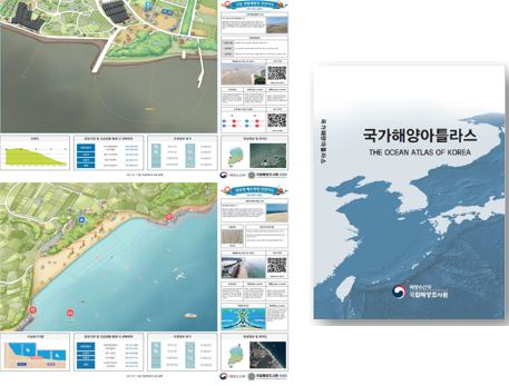
Publish “National Ocean Atlas”
Upgrade thematical maps synchronizing charts and publications in tune with the times.
Visualize the spatial information
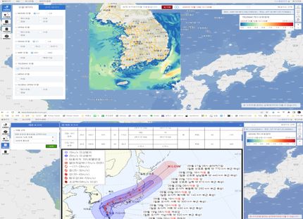
Display the maritime prediction numerical model data & observation data
Analyzing the accuracy of prediction data & comparative analysis of current state
Develop the system to visualize the maritime spatial information including writing typhoon reports, etc.
Responsibility: Data Headquarters.
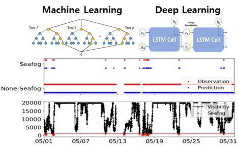
AI (artificial intelligence)
Predict time series, differentiate and search out images based on AI
Sea fog
Predict sea fog formation and dissipation, discriminate sea fog CCTV images based on AI
Numerical model, data assimilation (4-dimentional variation)
Raise the accuracy of prediction by improving initial conditions of numerical model
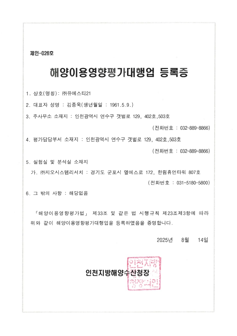
Sea area Utilization consultation & Environmental Impact Assessment on utilization of sea area
Analyze and predict environmental impacts caused by development and utilization on the sea, and suggest the ways to lessen the impacts
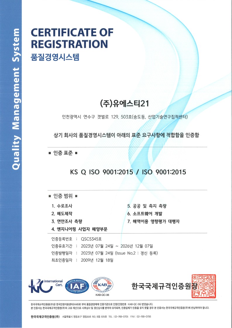
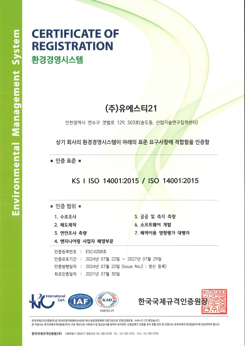
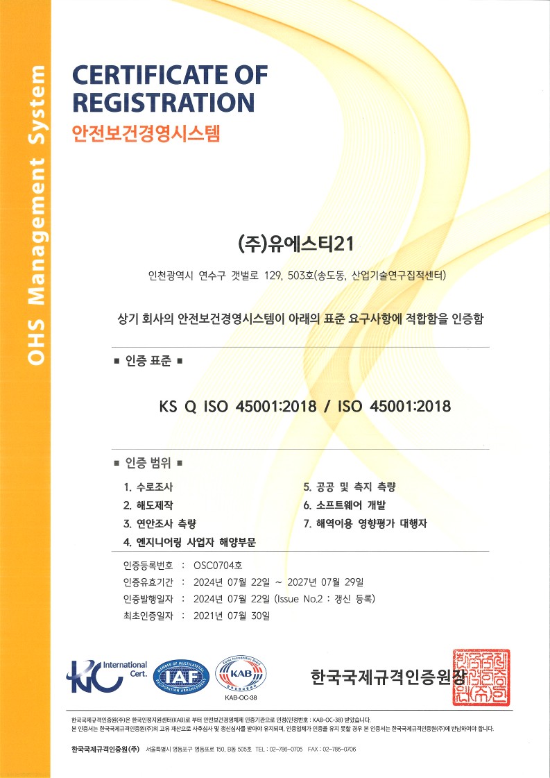
Primary Business & Certifications
UST21 registered QHSES(Quality, Health, Safety, Environment and Security) Certification pursuant to the international standards to respond to Orsted, Cop, Fugro, etc.
License
Certification
Agreement
Affiliated Institute Certification
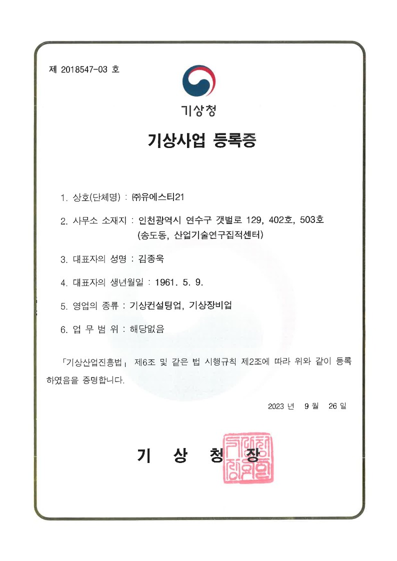
Engineering Business
Software Business
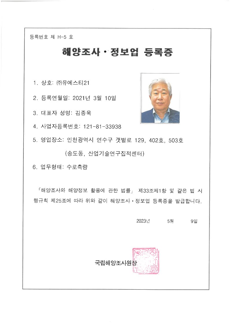
Hydrographic Business
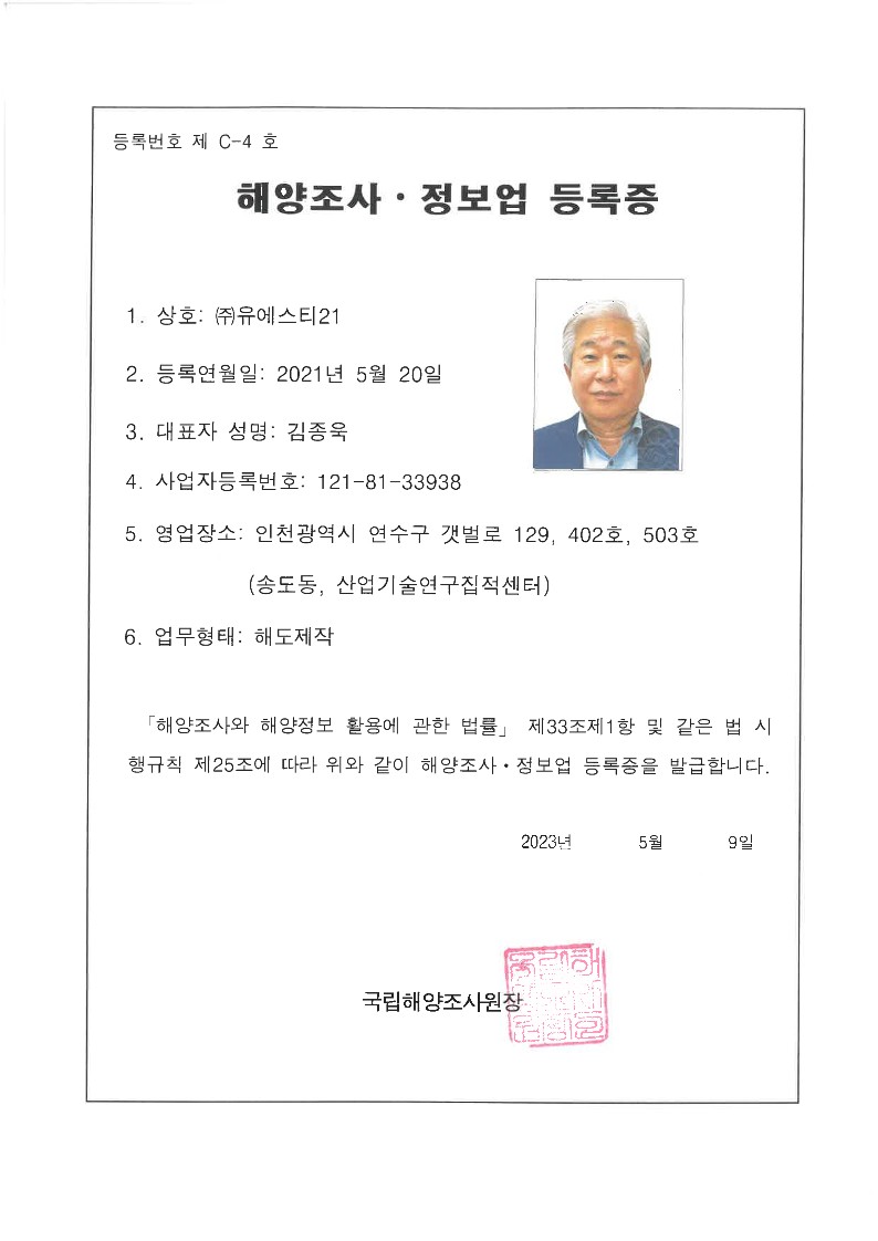
Cartography Business
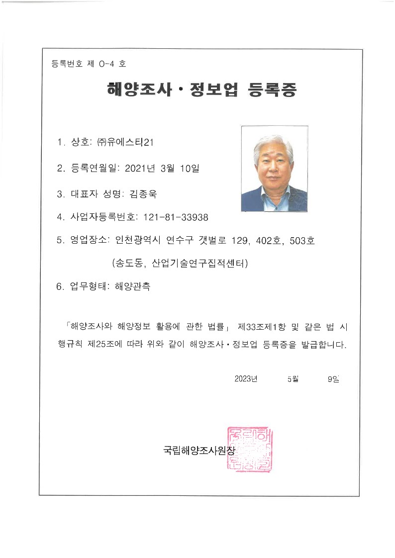
Maritime Survey
Maritime Information Service
Environmental Impact Assessment Agency on utilization of sea area
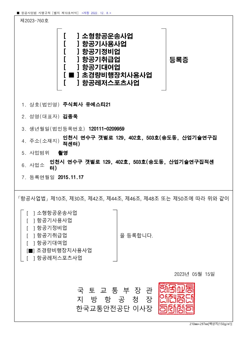
Ultra-Light Plane Use Business
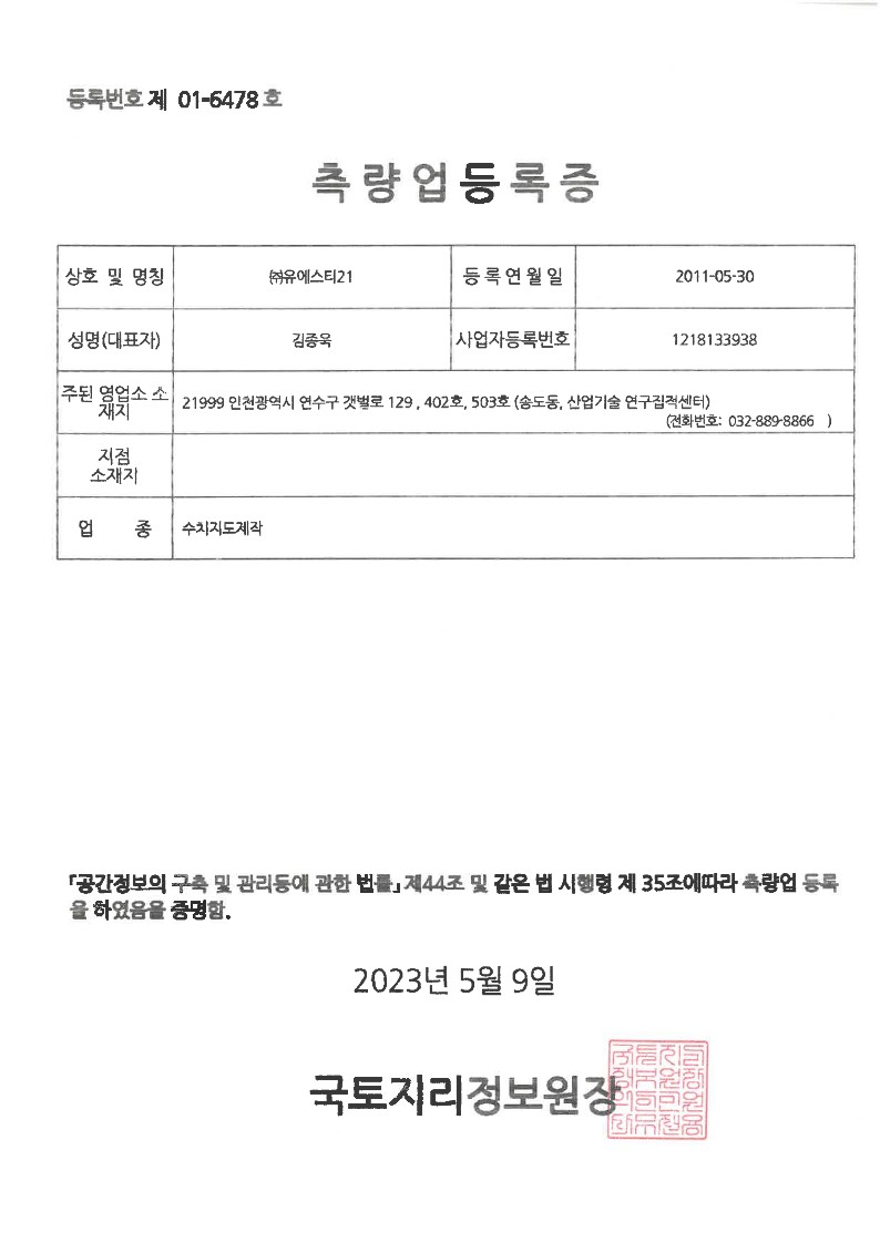
Numerical Chart Producing
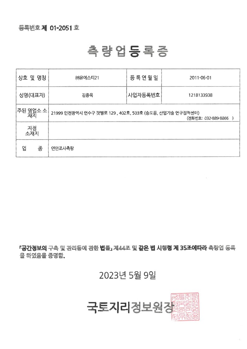
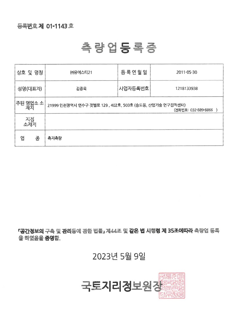
Coastal Survey
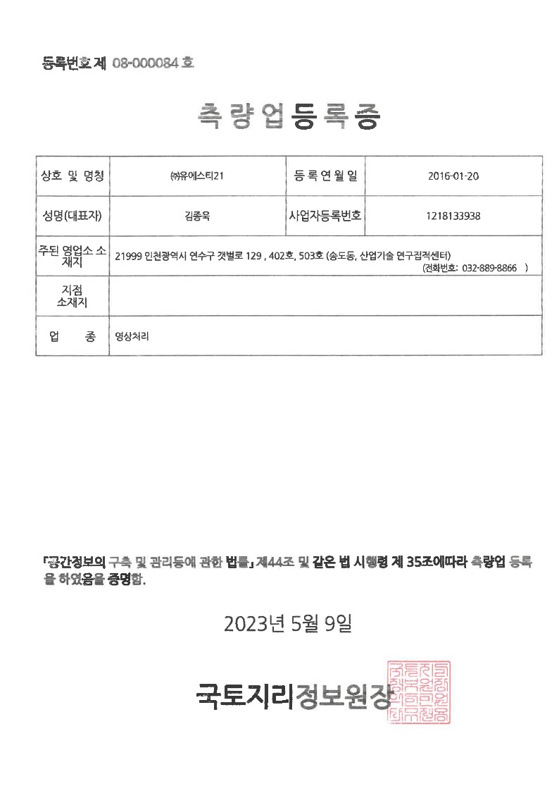
Data Processing
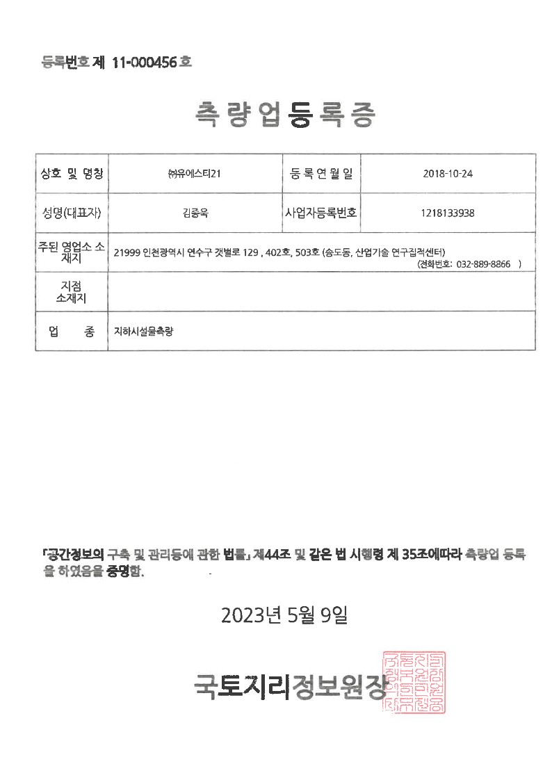
Underground Facility Survey
Surface Survey
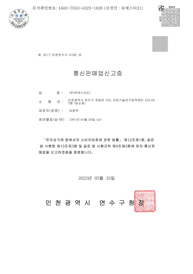
Retail Sale Via Mail Order Houses
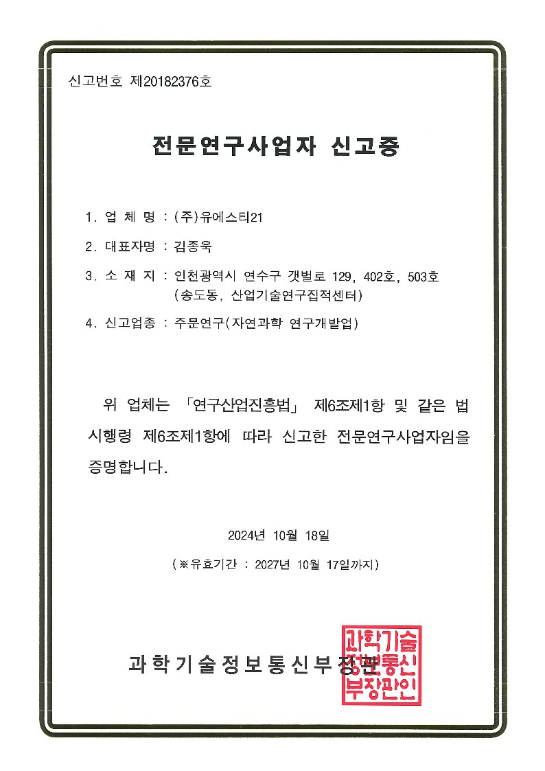
Research and Development
Weather Equipment Service
Weather Consulting Service
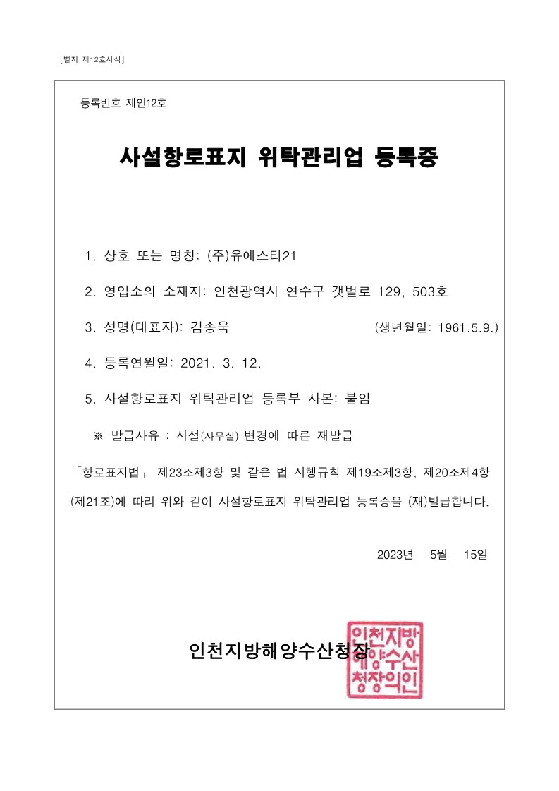
Private Aids Facilities Support Management Services
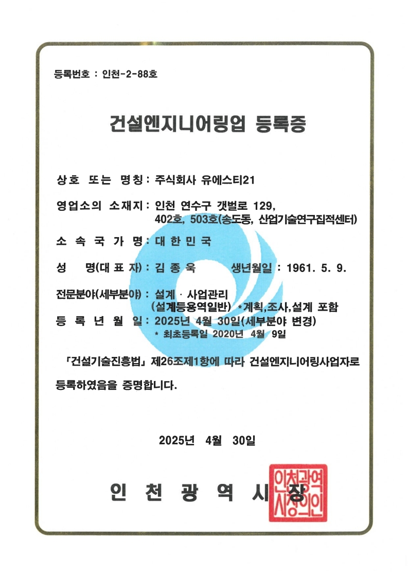
Construction Engineering Service
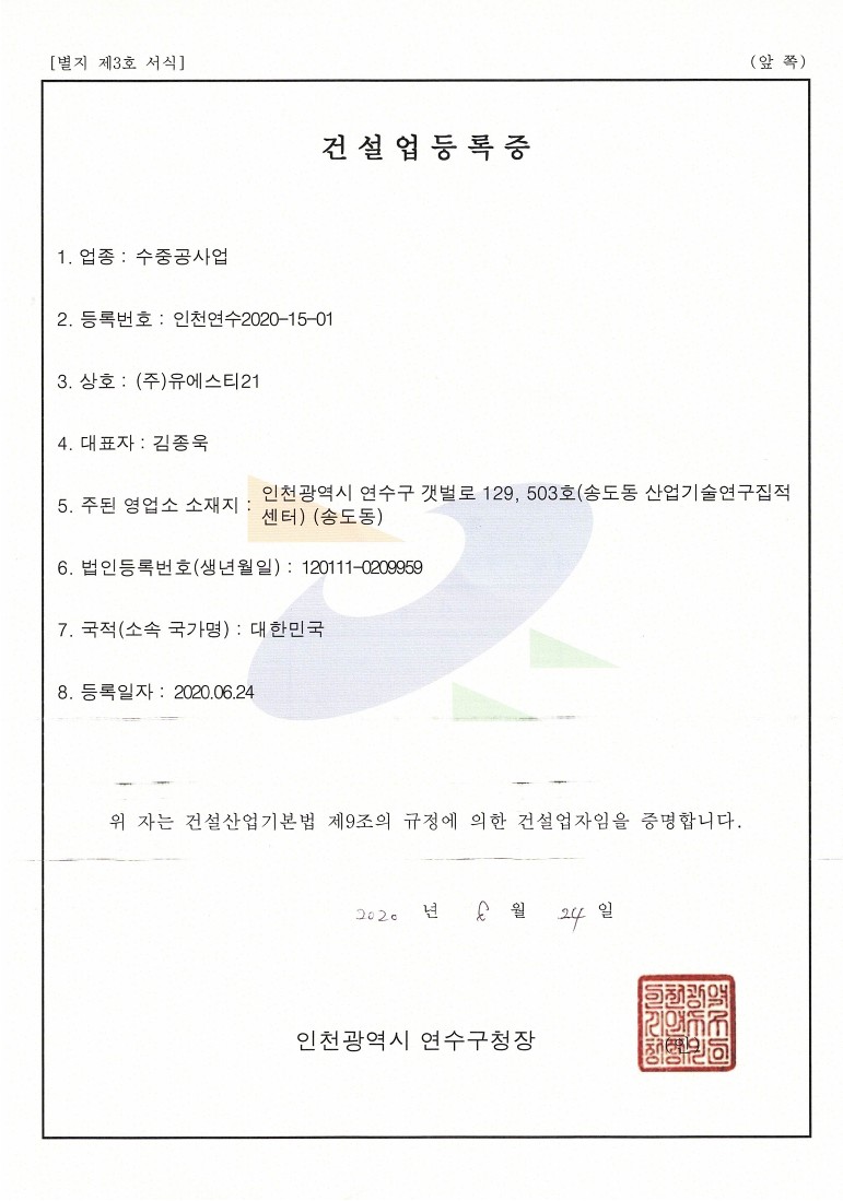
Underwater Construction Service
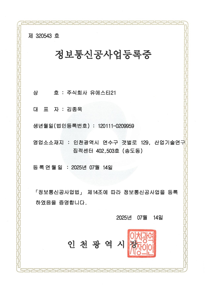
Information and Communications Construction Business
QMS: Quality Management System
EMS: Environmental Management System
Occupational Health and Safety Assessment Series
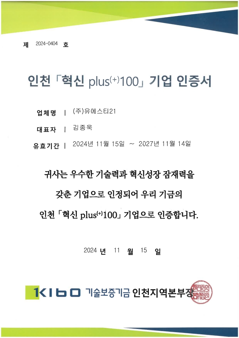
Incheon Innovation+100 Enterprise Certification
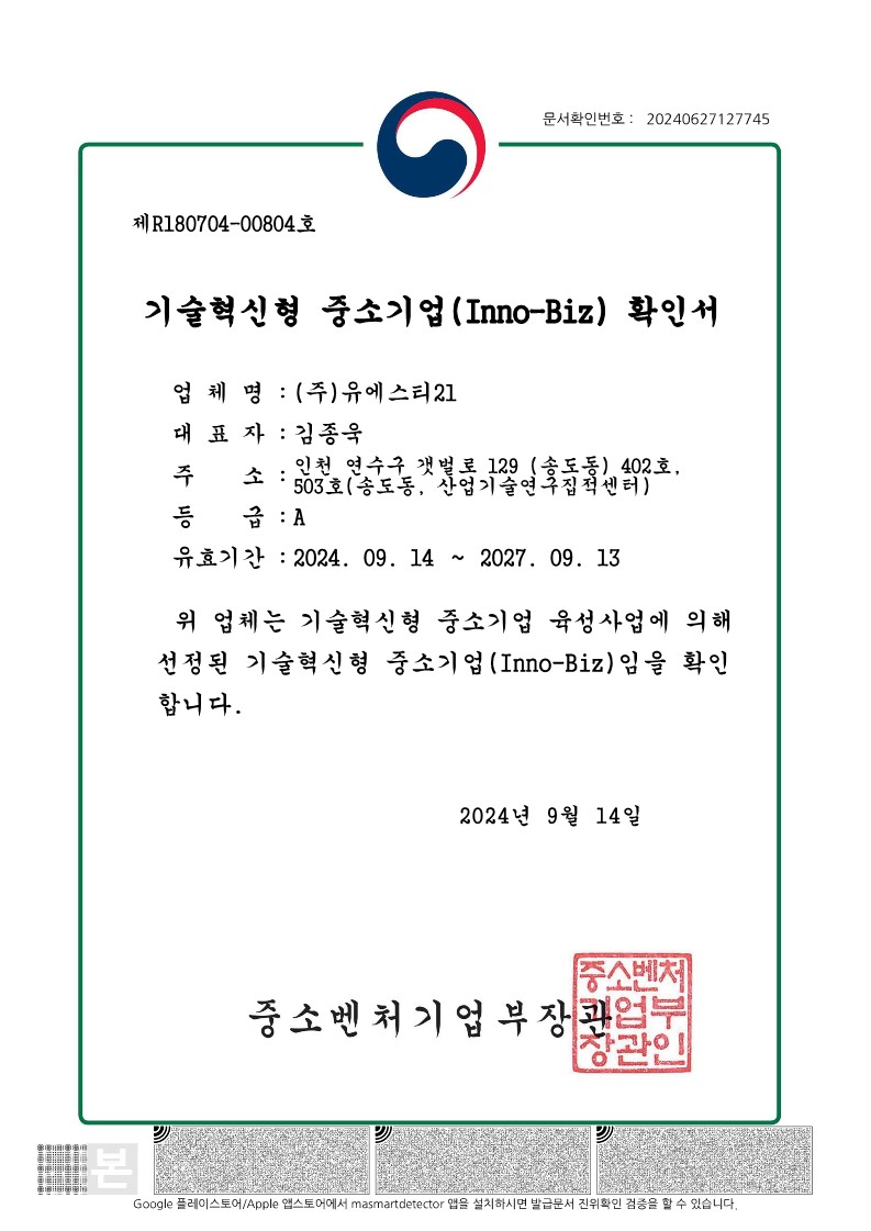
Innovation Business
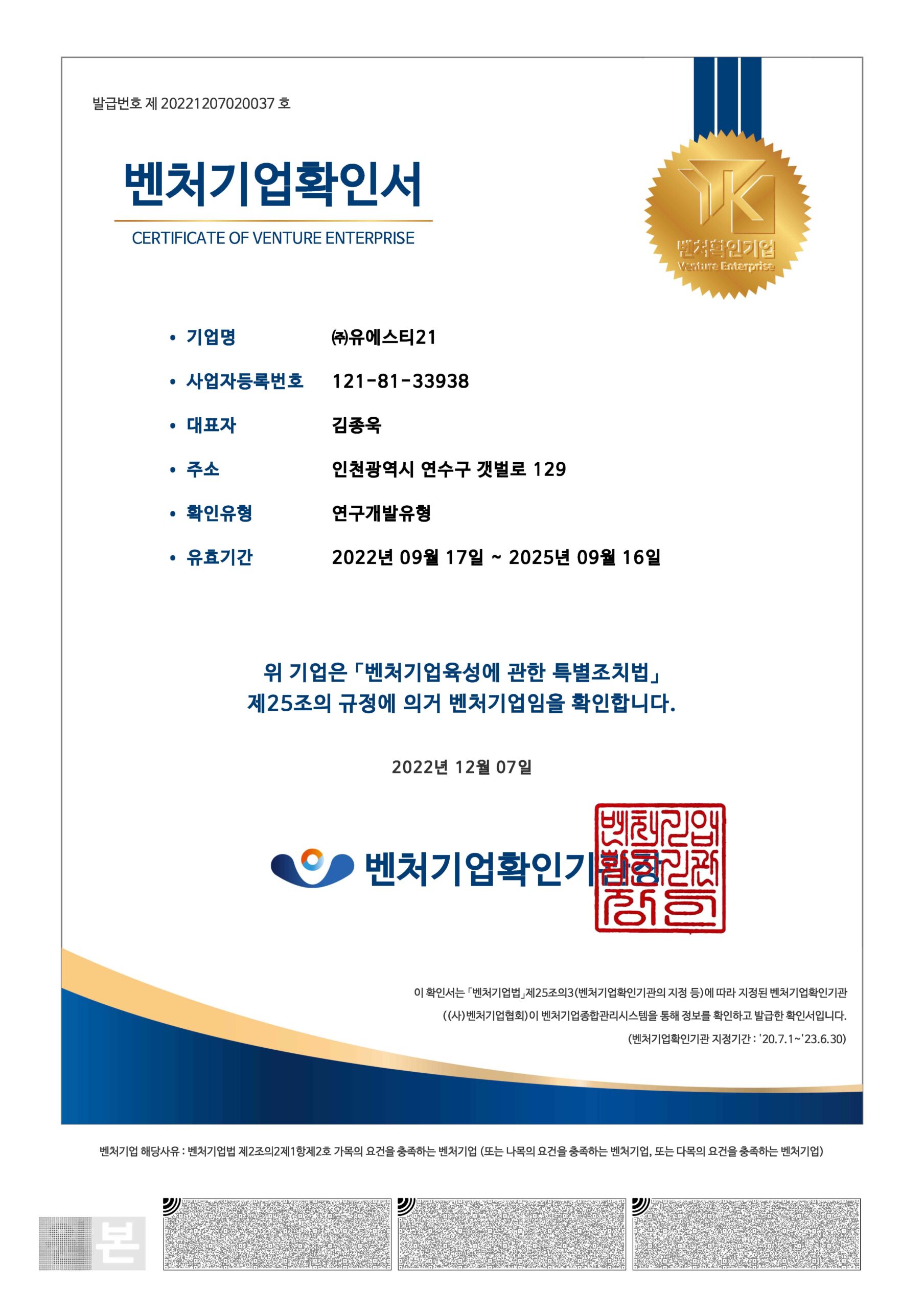
Venture Business
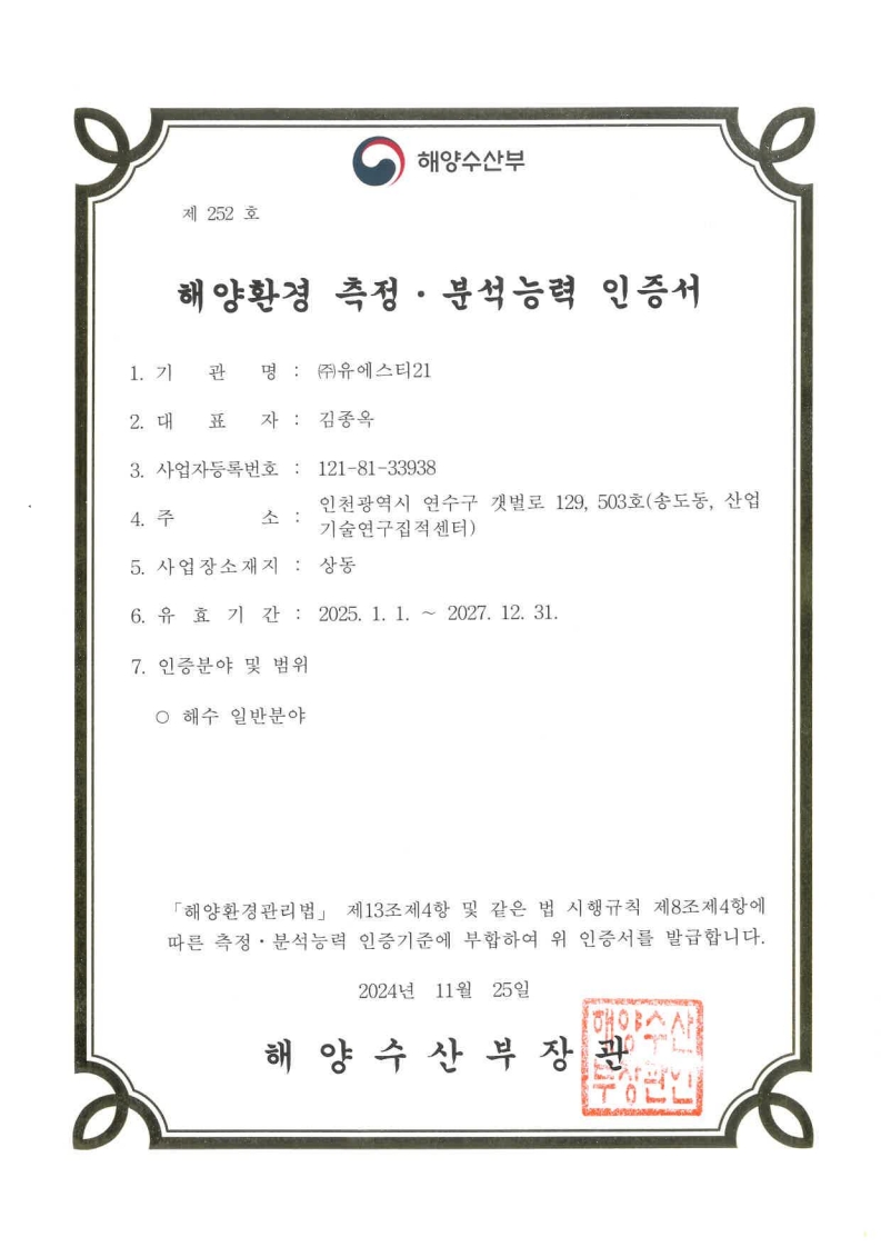
Certification of Marine Environment Measurement and Analysis Capability (General Seawater Field)
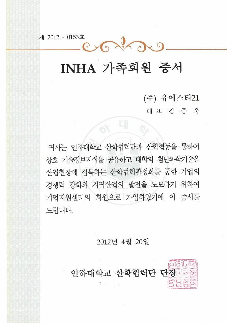
Family Members in Inha University
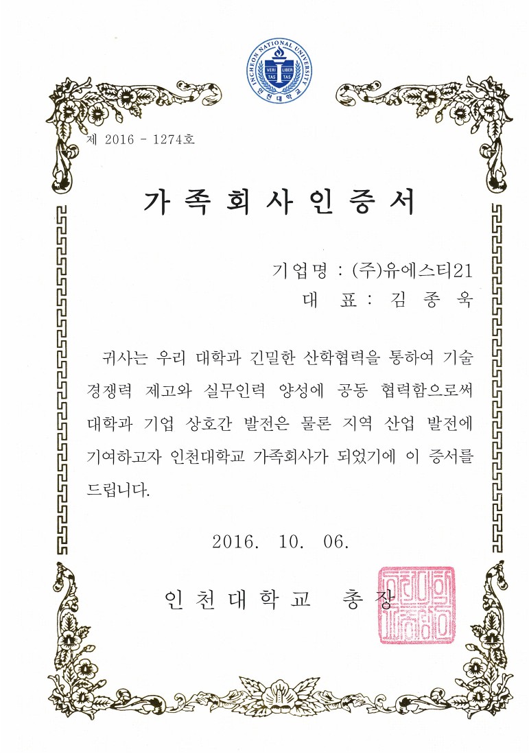
Family Members in Incheon University
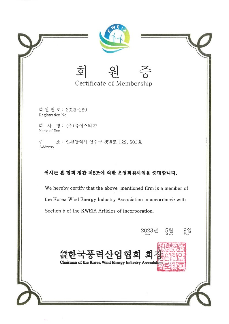
Member of Korea Wind Energy Industry Association
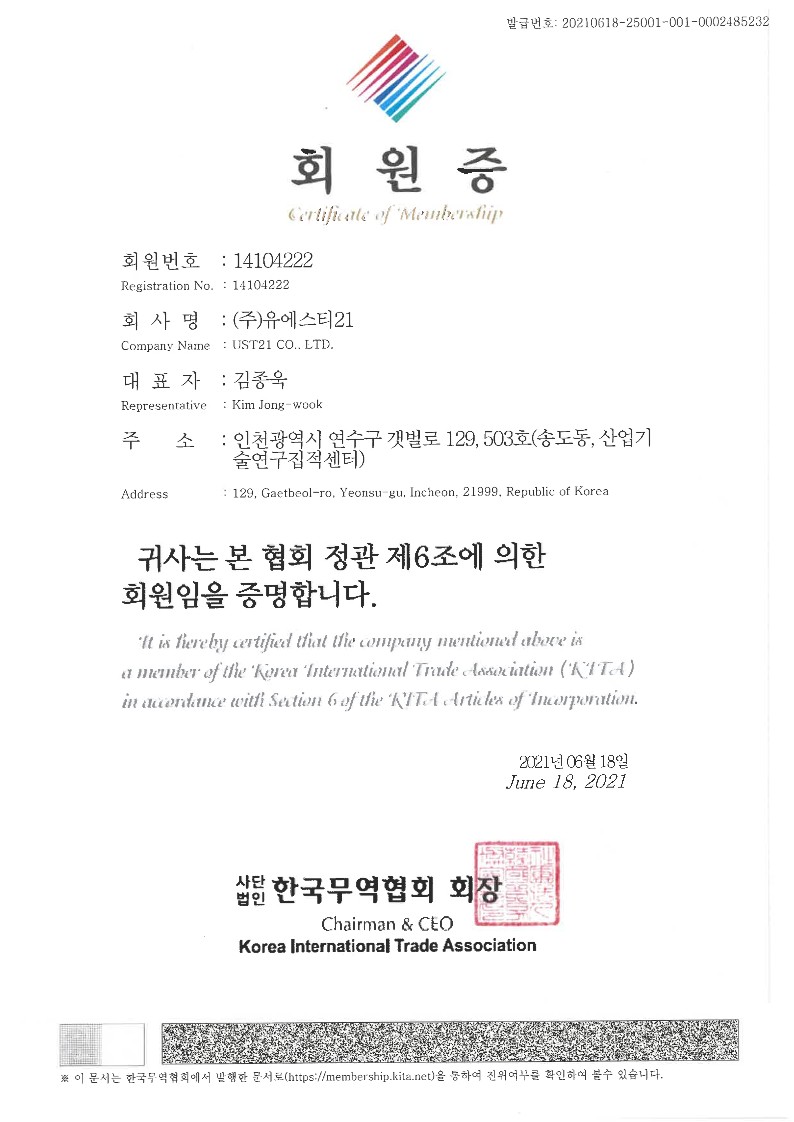
Member of Korea International Trade Association
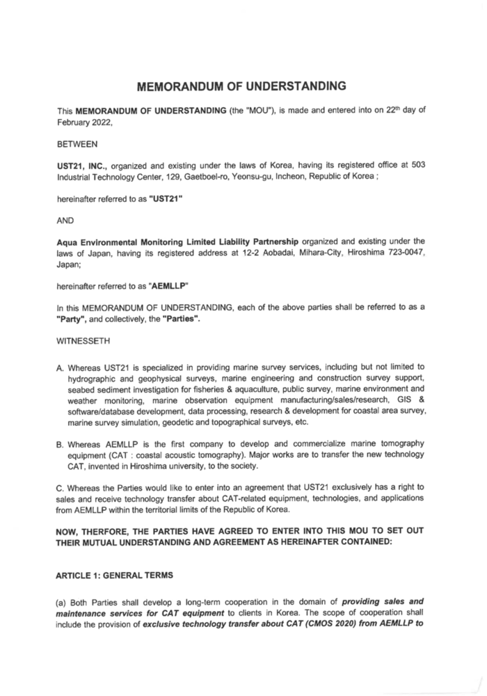
AEMLLP
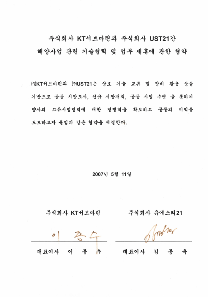
KT Submarine
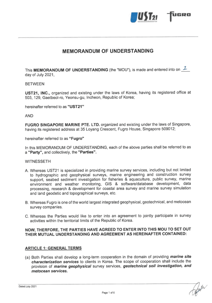
FUGRO
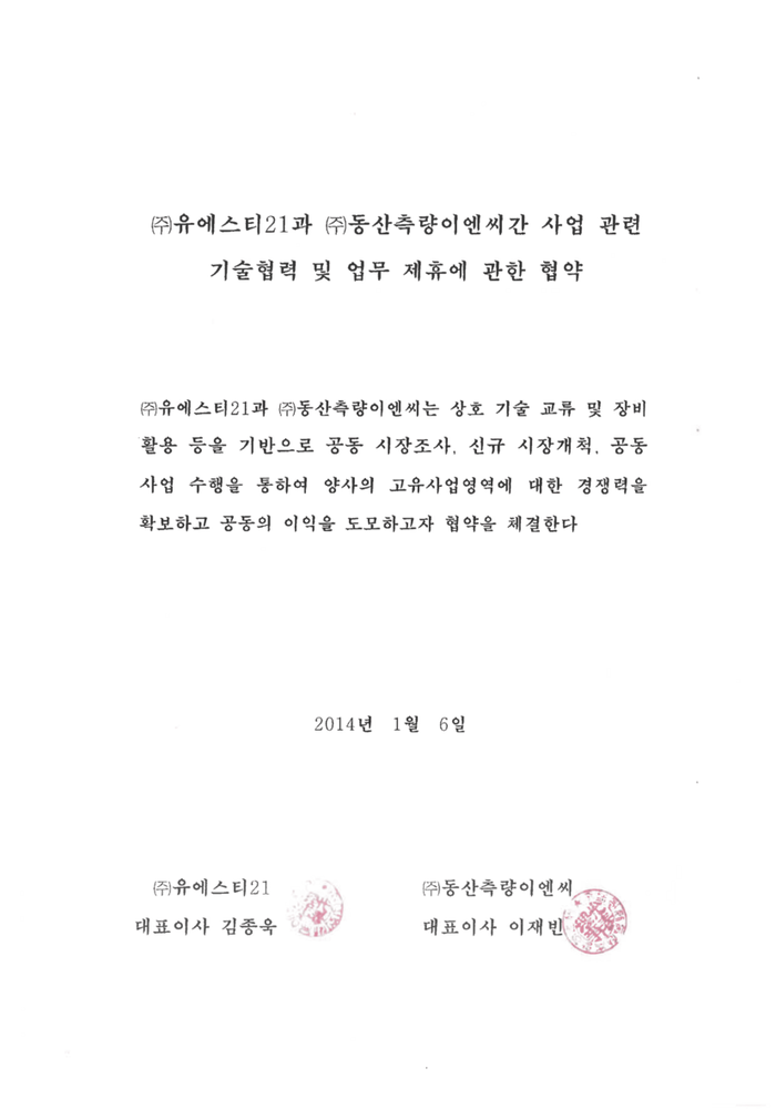
DongsanENC Inc.
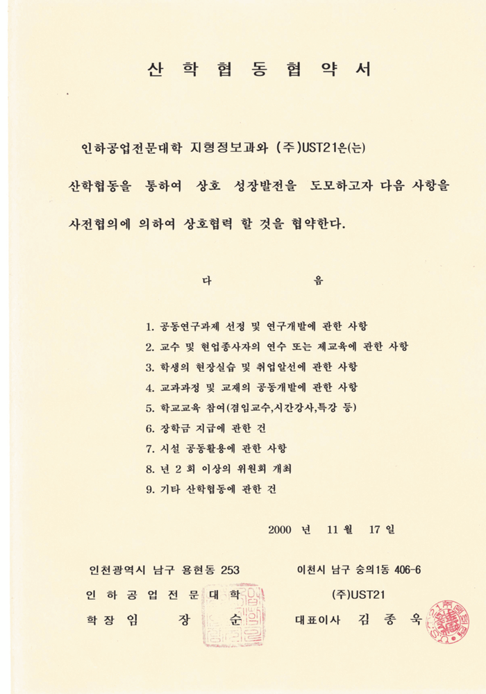
Topography Information Department in Inha Technical College
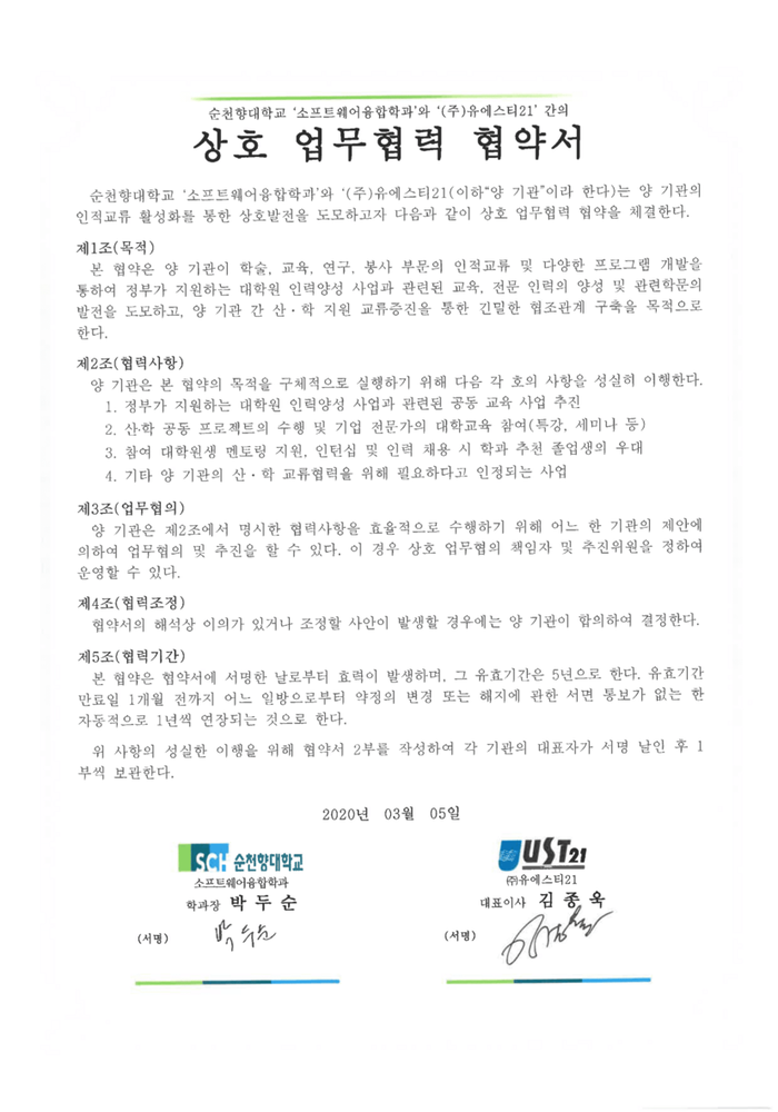
SoonChun Hyang University
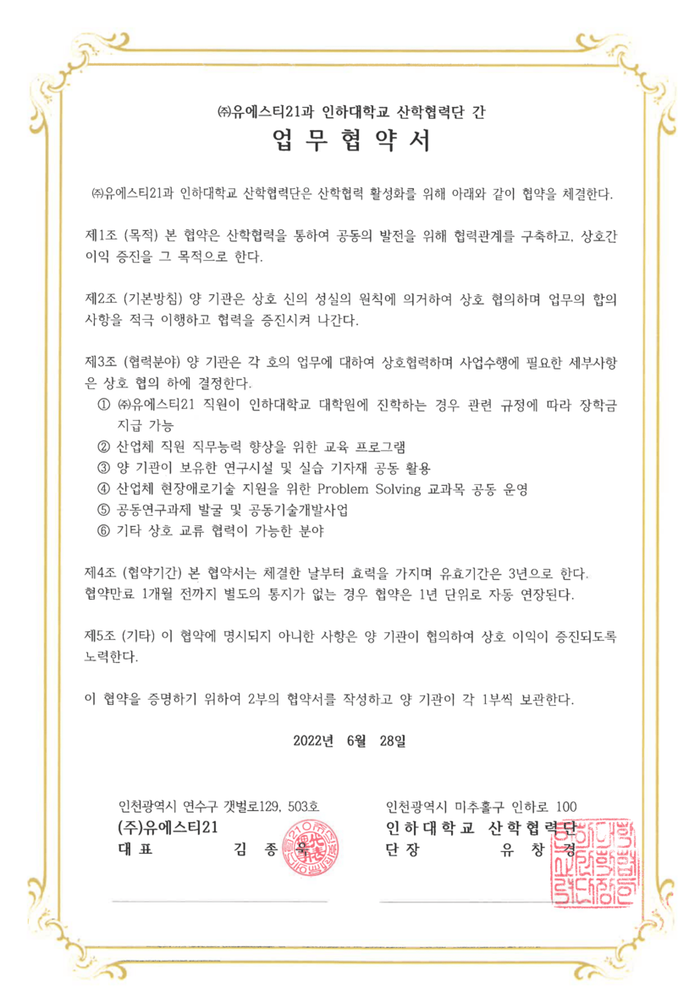
Industry-University Institute Collaboration of Inha University
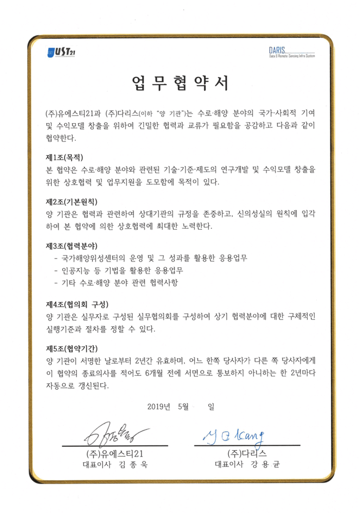
Daris Corporation Inc.
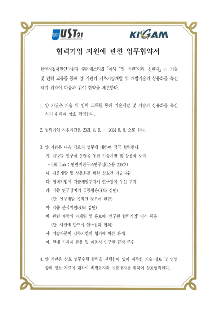
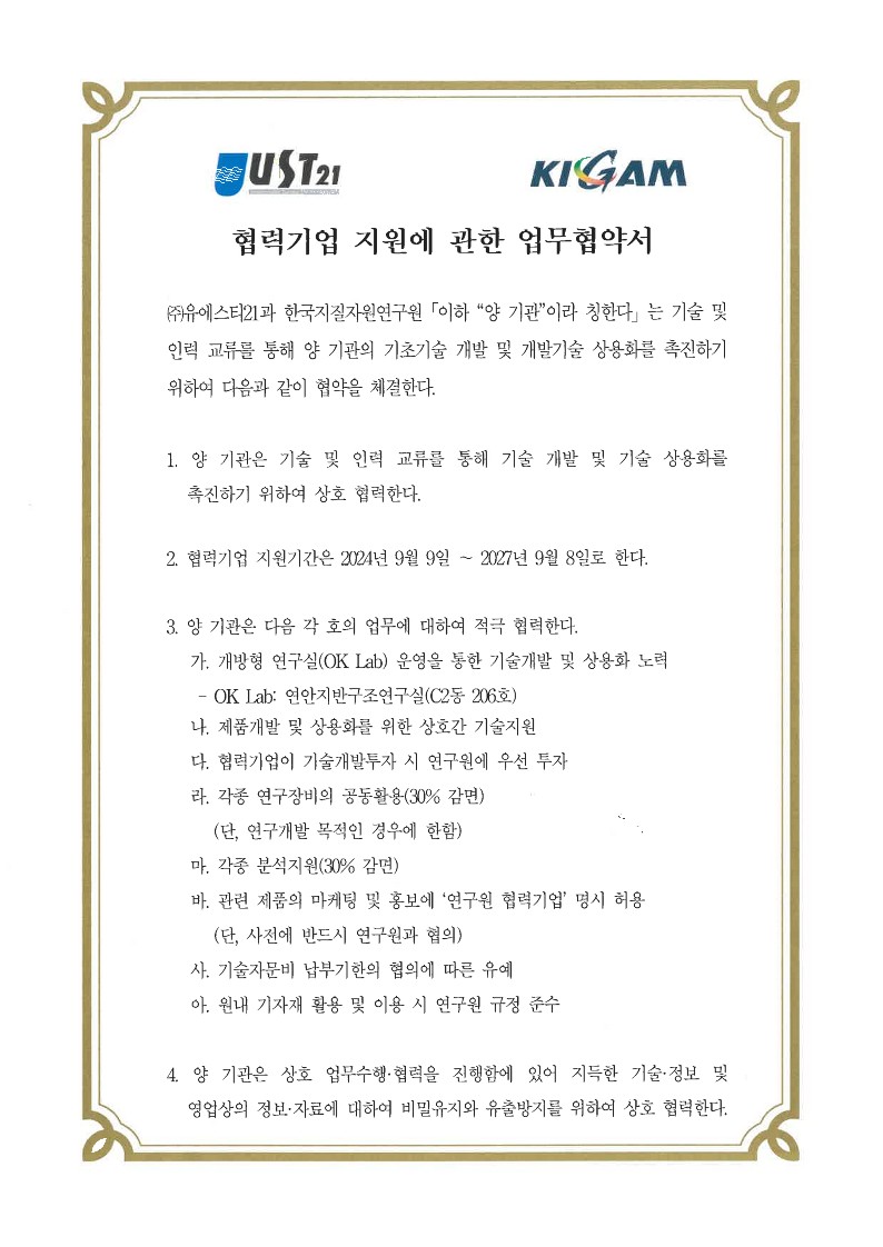
Korea Institute of Geoscience and Mineral Resources
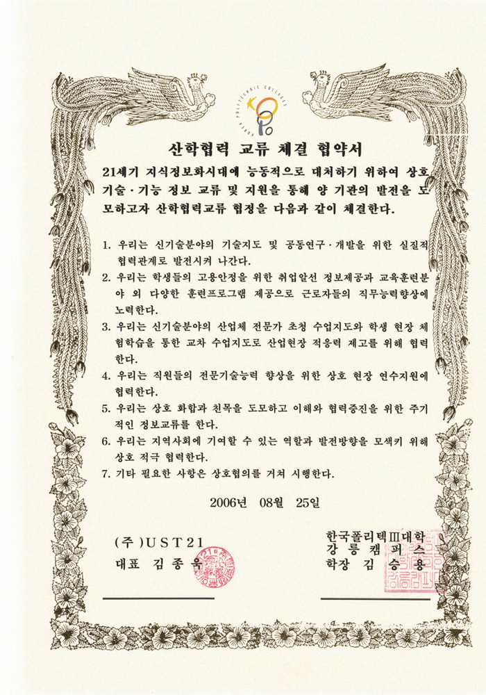
Industry-University Institute Collaboration of Korea Polytechnics III
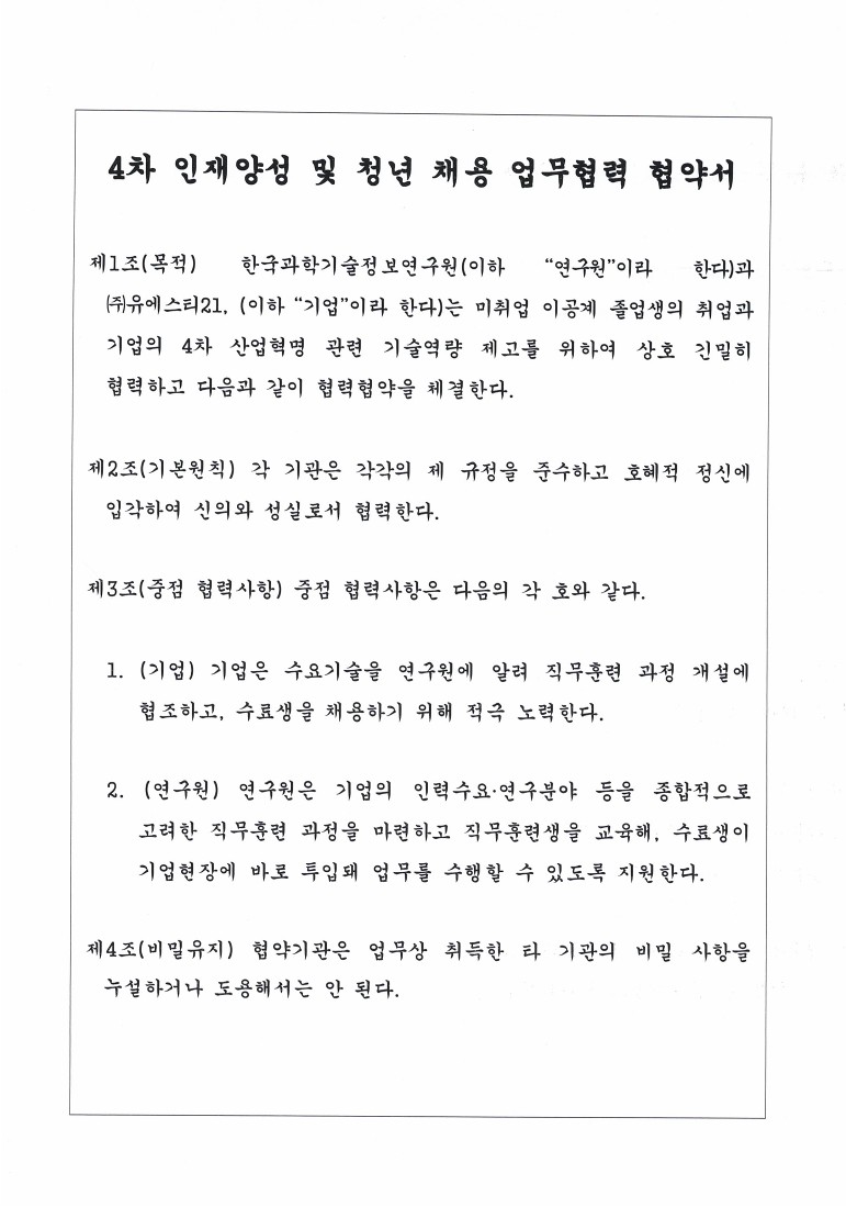
Korea Institute of Science Technology Information
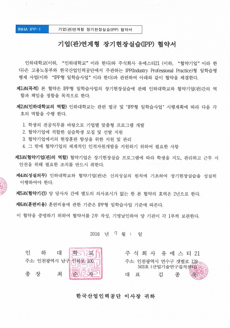
long-term field study (IPP-Industry Professional Practice) with Inha University.
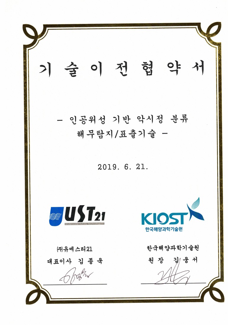
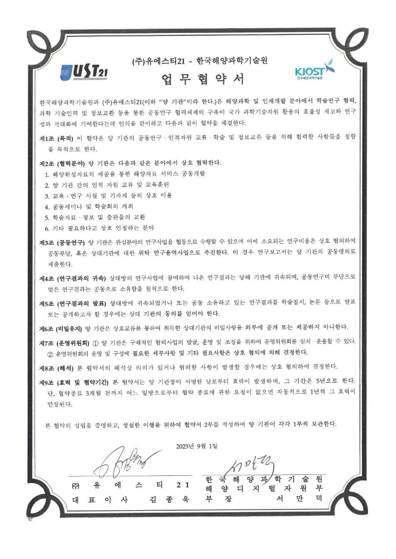
Korea Institute of Ocean Science & Technology
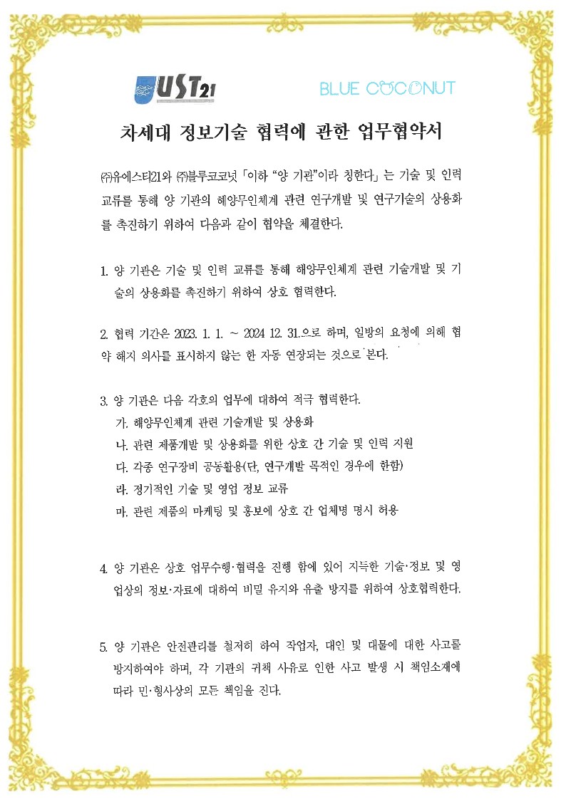
Blue Coconut Inc.
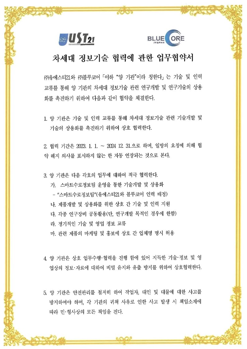
Blue Core Inc.
SGMA Inc.
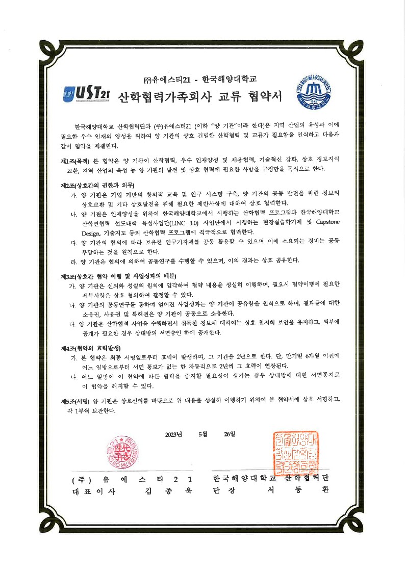
National Korea Maritime &Ocean University
Korea Institute of Ocean Science & Technology
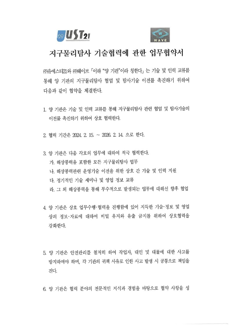
Wave Inc.
Korea Institute of Geoscience & Mineral Resources
Haeweon Cultural Heritage Research Institute Foundation